News Paid
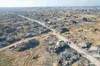
Apple Maps Has Removed Place Names Across Lebanon Amidst Israeli Invasion
About the author
Latest articles
Related coverage
-
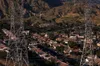
Venezuela
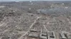
Venezuela's Earthquake Toll Rises Above 2,200, With Tens of Thousands Still Unaccounted For
-
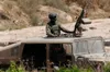
Israel
Israel Wants to Install Weapons in Space
-
News
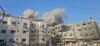
Child Amongst Three People Killed in Israeli Drone Strike on Gaza
-
News
Iran Responds to Second Night of U.S. Bombing with Strikes on Kuwait and Bahrain.
You may be interested in
Gaza
Israel Attacks Kamal Adwan Hospital in Gaza, Wounding Hospital Workers
Israel and Lebanon have a long history of failed ceasefires – will this time be any different?
Gaza
Israeli Drone Strike Kills Two Palestinians West of Khan Younis
Gaza
Two Children Amongst Nine Killed in Israeli Attacks on Gaza
Israel’s ‘campaign between the wars’: How strategy to contain Iran and its allies risks further straining ties with US

Israel
Israel to Put Palestinians in "Board of Peace" Concentration Camps
From this writer
Can a power company take your land to support a data center? It depends

DHS Plans “All-Out War” on Immigration Scammers as Fraud Complaints Double
This Private School Had Students Scrub Floors and Attack a Fellow Classmate. The State Still Funds It.
ICE
12 Scary Things ICE Can Legally Do in 2026
U.S. Politics
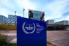
USA Launches Campaign to Dismantle International Criminal Court